
The Orange Line: How Israel Is Reengineering Gaza
Satellite imagery and legal experts warn that Israel’s expanding “Orange Line” is steadily shrinking Gaza’s habitable area and imposing a new demographic and geographic reality by force.

Palestine, PUREWILAYAH.COM - In the Gaza Strip, where maps are no longer mere lines on paper, what has come to be known as the “Orange Line” is emerging as the defining feature of a new reality on the ground. Here, geography intersects with military power, and what was once a theoretical boundary has become a daily reality shaping every aspect of civilian life.
This line, though never officially announced, has been advancing gradually across the territory. It represents an extension of what was previously known as the “Yellow Line,” established under the ceasefire agreement of October 10, 2025. That line was intended to separate areas under Israeli control in the east from zones in the west where Palestinians were permitted to remain.
From Temporary Boundary to Expanding Frontline
What followed, however, did not unfold according to that framework.
Field data, supported by satellite imagery and international reports, indicate that this boundary has been moving slowly but steadily deeper into Gaza through the repositioning of concrete barriers and separation points.
This process has created a new reality now referred to as the “Orange Line” — an undeclared boundary reflecting a further expansion of effective Israeli control.
While the original Yellow Line encompassed approximately 53 percent of Gaza’s total area, recent estimates suggest that this figure has risen to nearly 59 percent. Some reports indicate that, within a broader and overlapping system of military control, the area affected may now reach as much as 64 percent.
In several areas, this expansion approaches Salah al-Din Road, the vital artery connecting northern and southern Gaza.
Land Withdrawn From Life
On the ground, these figures are not experienced as abstract percentages, but as portions of life being systematically erased.
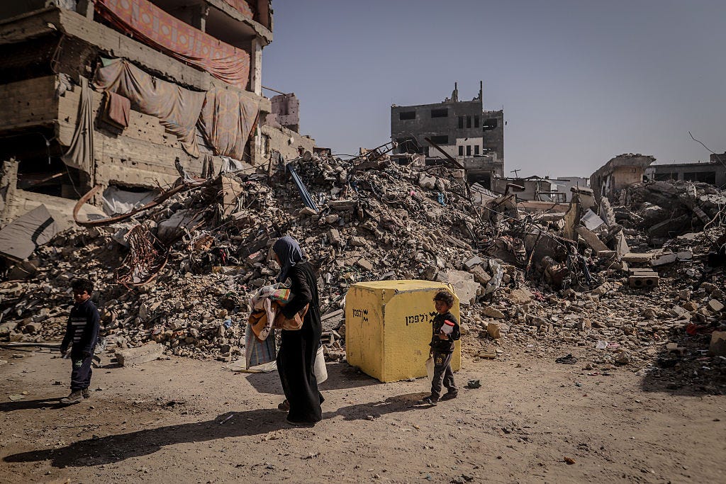
Where neighborhoods once stood, empty spaces now precede the people. Streets lie in ruins, buildings are uninhabitable, and vast areas have been transformed into dangerous or inaccessible zones.
With every advance of the line, the space available to civilians continues to shrink, intensifying pressure on what remains.
Local estimates suggest that no more than 15 percent of Gaza’s territory remains genuinely habitable. Within this small and devastated area, hundreds of thousands of Palestinians are living in tents or amid the rubble of destroyed neighborhoods, while the humanitarian situation grows increasingly fragile under the ongoing blockade and the continued ban on reconstruction materials.
Invisible Walls and a New Geographic Reality
In this context, the “line” has become far more than a military term.
For Gaza’s residents, it has evolved into a daily instrument of confinement.
Activists say that boundaries originally presented as temporary security measures have become “invisible walls” that restrict movement and redefine space itself. Others describe them as a mechanism of gradual suffocation, reducing the available territory and imposing an entirely new reality on the ground.
A Demographic and Geographic Transformation
In a legal assessment of these developments, legal adviser and international law expert Osama Saad warned of the serious implications of the so-called Orange Line, describing it as a grave violation of the ceasefire agreement and an attempt to impose a new demographic and geographic reality by force.
In remarks to the Palestinian Information Center, Saad said this process cannot be separated from broader policies that, in his view, amount to crimes of forced displacement and ethnic cleansing.
He noted that confining civilians to increasingly narrow and hazardous areas, while restricting movement and depriving them of the basic conditions necessary for life, constitutes a clear violation of international humanitarian law, particularly the legal protections afforded to civilians.
Saad added that the danger of these measures lies not only in their immediate consequences, but also in their gradual normalization, as temporary arrangements evolve into de facto permanent borders and Gaza’s geography is reshaped outside any genuine political process.
The “Color Engineering” Strategy
This legal analysis aligns with findings published by the French investigative outlet Mediapart, which described what it called a strategy of “color engineering.”
According to the report, this strategy relies on the gradual drawing of control lines, each marked by a different color, which collectively serve to entrench a long-term system of military domination over the Gaza Strip.
As the colors on the map continue to change, one reality remains constant: these lines are reshaping the lives of Gaza’s people.
They do not merely determine where Palestinians may exist. They define where they may move, where they may live, and where life itself comes to an end.
As this expansion continues, fears are mounting that the “Orange Line” will cease to be a temporary field description and become a permanent stage in a broader process through which the Gaza Strip is redefined as a fragmented territory governed by boundaries that advance far more often than they retreat. (PW)